
Put aerial data to WORK

-
Site scanning - 2D maps (.geotiff), 3D models (.obj), point cloud (.las. .xyz), contours (.shp), elevation models (.dem) other formats may also be available.
Progress photography/videos
Hi-resolution sensors - 20MP, 24MP, 48MP
RTK* and PPK* workflow for high spatial accuracy
Flight planning for repeatable data capture
Cut/fill estimates
Airspace authorization/waiver processing
-
Speed of service - data available within 24 hours, we usually do it quicker
Up-to-date visual models and maps keep track of the project, ensuring quality of work.
Annotations and shareable reports throughout the departments available trough Drone Deploy platform (additional fee required for full functionality)
Visual material for insurance claims
Access to dangerous or hard-to-get locations
Additional use of data - plant health monitoring and count, stockpile volume calculation
-
Every construction project requires specific approach. You can choose between a single visit or reoccurring data capture. Our team will consider airspace restrictions and other risk factors and get back with a quote. For the repeating visits, our specialist will visit the site and design a safe, effective, and repeatable workflow.
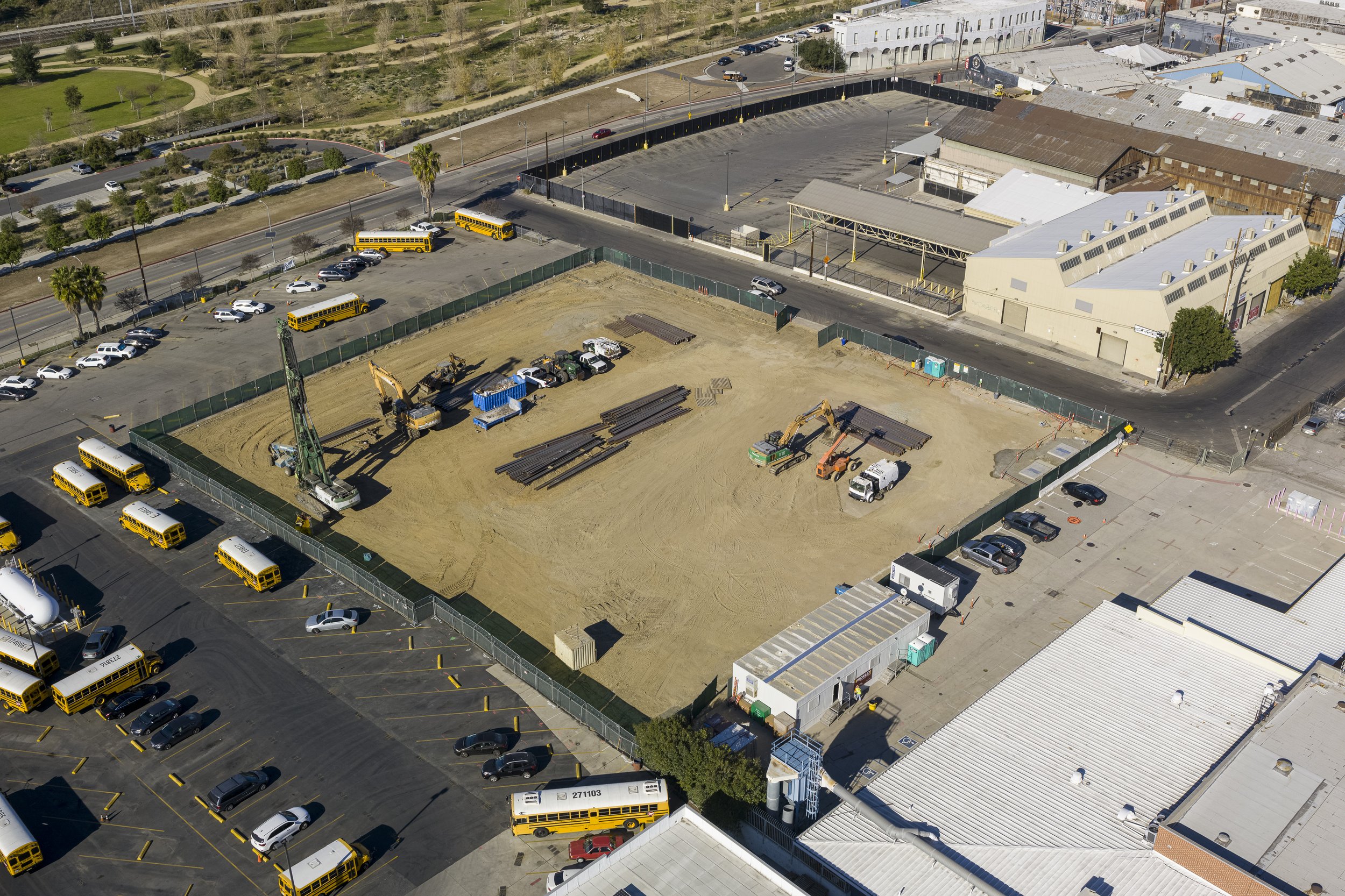
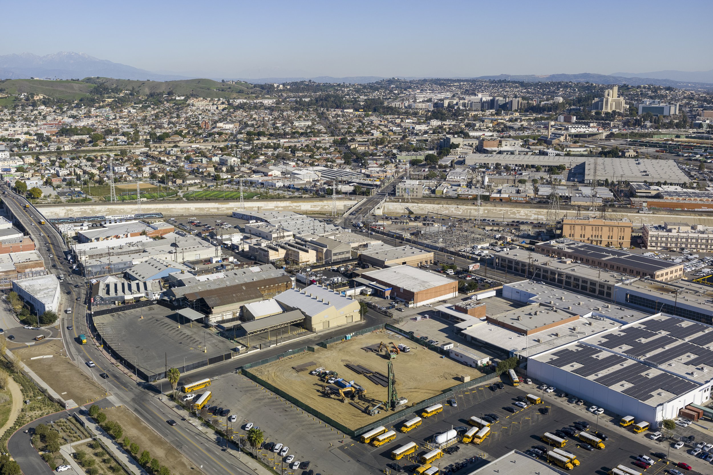
Drones in construction deliver a new layer of useful information throughout the entire construction process. From progress photographs to detailed point clouds, our data will bring your project to the next level. Our team can design and execute repeatable and effective flight plans and bring you the data you need within a day.
Our standard workflow
Our clients can choose between a one-time visit or recurring data capture.
Single visit service
“Pretty” pictures - standard or custom photographs
Video - raw and/or edited
Photogrammetry with or without ground control
360° panoramas for virtual tours
Recurring data capture
Our most popular package combines progress photography & video with mapping
Add 360° panoramas for an immersive visual experience
Hi-resolution sensors for rebar and PT cable scans
Timelapse footage
Safety
All our operations are planned according to the local and FAA regulations. Our pilots are FAA-certified. Safety in the air and on the ground is the single most important factor of all our operations. Therefore, specific flight plans and scope of available deliverables may vary from project to project based on our safety analysis.
Equipment

DJI Phantom 4 Pro V1/V2 - "The workhorse" industry-standard aircraft featuring one-inch 20MP sensor with mechanical shutter for accurate photogrammetry results and crisp 4K video footage.

DJI Inspire 2/X7 camera with 16, 24, 35, 50 mm F2.8 lenses on a 24MP APSC sensor for capturing beautiful still images, and cinema-quality 4K ProRes footage. This is a very powerful tool for marketing.

For projects demanding the highest level of accuracy, we recommend using the DJI M300 RTK aircraft with P1 camera, a full-frame 48MP sensor. The factory-calibrated 35mm lens is specifically designed for high-accuracy photogrammetry with 3D modeling in mind.

*We use solar-powered PPK (post-processed kinematics) ground control points together with RTK (real-time kinematics) drones to achieve the most precise mapping workflow currently available.
Software
Complete Reality Capture
Ground control for drones
FAA airspace interactive map
Standard progress capture
We capture the site from eight cardinal directions in higher and lower altitude, usually 300-400ft, and 100ft, depending on the size of the site. We pre-program the flight path for repeatable capture throughout the length of the project. We also capture five additional images recording the “action” of the day.


Two videos
As part of our standard capture we provide you with an orbit and a dolly shot.
Edited video
Add some pizzazz to your documentation.
HDR
High Dynamic Range photographs look more realistic with even shadows/highlights and saturated colors when viewed on an HDR-enabled display.

360 panorama virtual tour
Hi-resolution rebar scan

Hi-res ortho map of rebar before a concrete pour. AutoCAD drawing is overlayed. This is an example of our hi-accuracy rebar scan using a DJI Inspire 2 with X7 camera and Aeropoints for ground control. Over 500 photos were used to stitch the image. Ground Sampling Distance ~ 0.2in/pixel.